| Developer: | Dianthus AB (1) | ||
| Price: | * Free | ||
| Rankings: | 0 | ||
| Reviews: | 0 Write a Review | ||
| Lists: | 0 + 0 | ||
| Points: | 0 + 2 ¡ | ||
| Points + 1 | |||
Description
")
The app comes in two flavors, Walter Maps and Walter Maps Pro. Walter Maps contains some editing features, and could be regarded as a reader app for geodata and maps produced by Walter Maps Pro. The target audience for Walter Maps Pro is professional users collecting geodata and producing maps.
In this version, Walter Maps, you can whenever you want unlock the Walter Maps Pro features monthly, i.e. you only pay for Pro functionality when you need it!
Important information about the Pro unlock subscription:
- The subscription unlocks the Pro functionality.
- This is a monthly subscription.
- The price per month is 10 USD.
- Payment will be charged to your Windows Store account at confirmation of purchase.
- The subscription will not be automatically renewed.
- Your account will be charged with 10 USD at renewal.
- The subscription does not contain any free trial period.
Walter Maps and Walter Maps Pro contain the following basic features:
- No ads
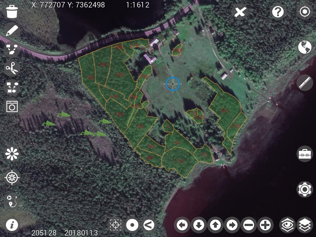
- Supports Shape, TIFF, GeoTIFF, JPEG, WMS, WMTS, and TMS
- Record waypoints & tracks
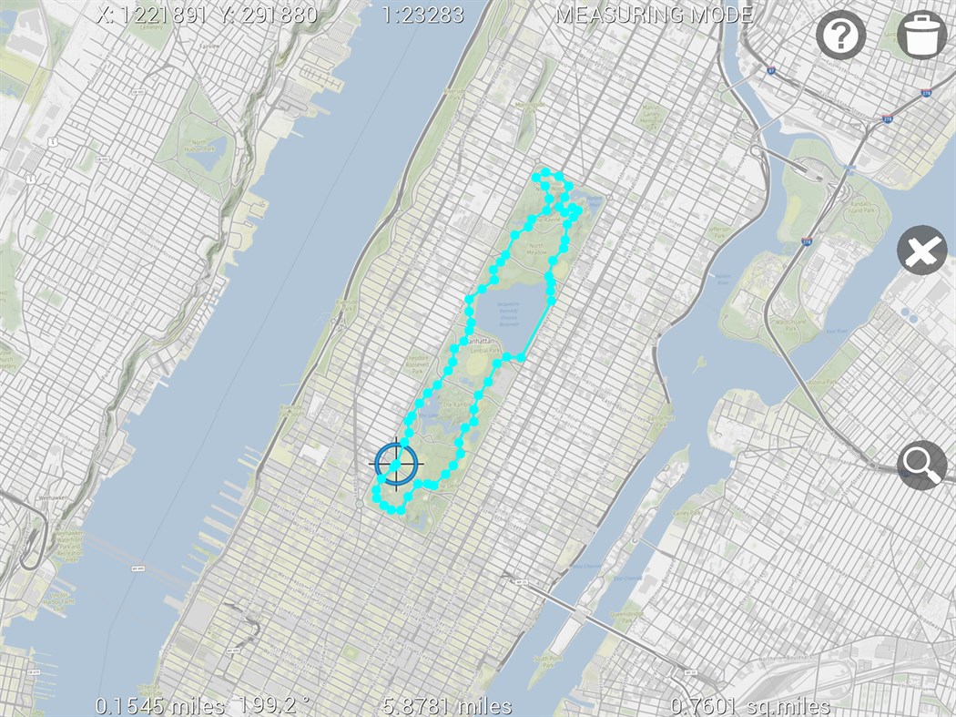
- Easy measurements of coordinates, lengths and areas
- Supports many length and area units, e.g. m, miles, yards, sq.feet, ha, acres etc.
- Supports any map projection (projected coordinate system)
- Add and delete points, polygons & lines
- Collect 2 photos/videos per point, line or polygon feature
- View and edit attributes
- Create own symbologies (one per map layer)
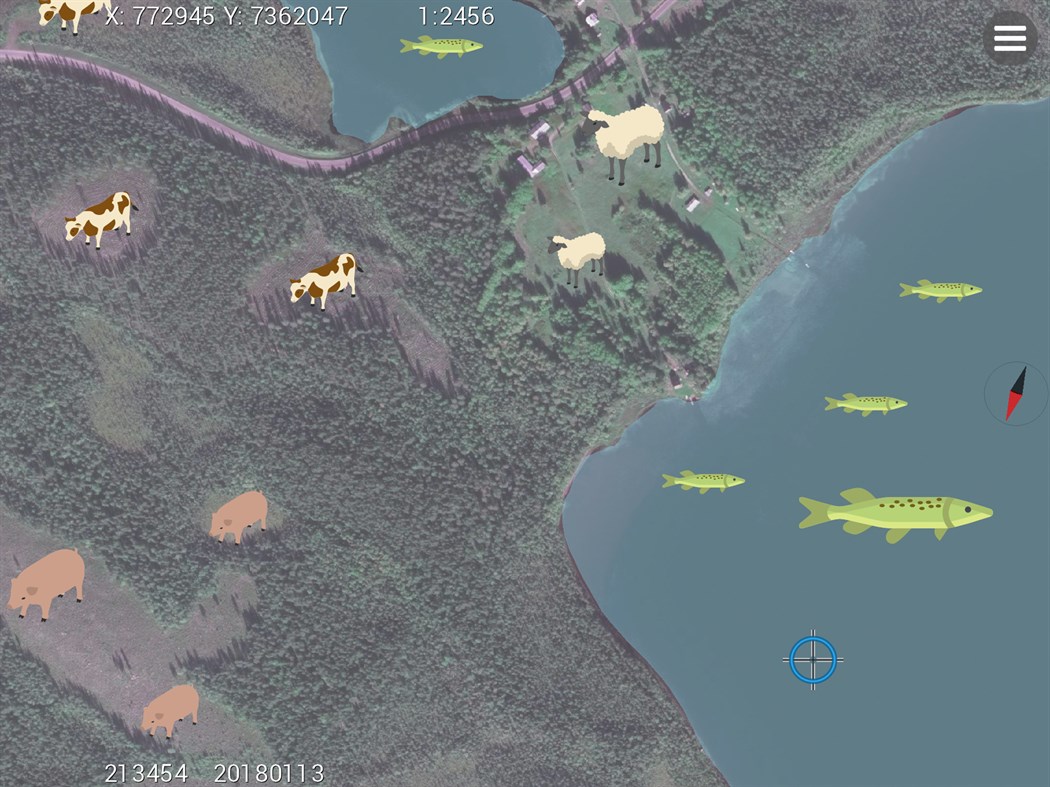
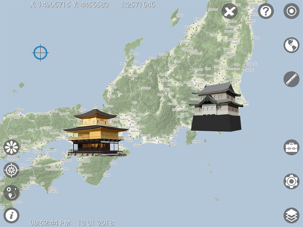
- More than 670 built in symbols for points
- Use own point symbols in svg-format
- Download single or multiple symbols in svg-format
- Create and open map packages
- Copy GPS position to clipboard
- Use Dropbox for sharing and backup of data
- Download layers from http URLs
- Multi lingual-support, i.e. create your own language files. Default languages: English and Swedish.
- Fully described JSON based map document and map package format.
Walter Maps Pro contains the following additional professional features:
- Merge polygon features
- Multi part features to single part features
- Split polygons by drawn lines or other line layer
- Clean polygons
- Single step undo of geometry edits
- Create new shape files
- Add new attribute fields to shape files
- Use custom built rules (single or multiple) for creating data collection forms
- Tools for assigning date, time, polygon area, line length or polygon perimeter, centroid, UUID, GPS position, cursor position and altitude, compass direction, device pitch and roll to field attributes
- Collect any number of photos/videos per feature
- Select photos from device album
- Import points from text files
- Export vector layers to text files or MS Excel (*.xls)
- Download layers from pw protected URLs
- Email complete map or selected layer
- Launch websites based on feature attribute values
- Save WMS, WMTS, and TMS layers to offline layers
- Use cached WMS, WMTS, and TMS in online mode
- Cut and resample raster layers
- Export present map view to jpg image
- Any number of conditional symbologies, i.e. symbology by field based SQL-queries
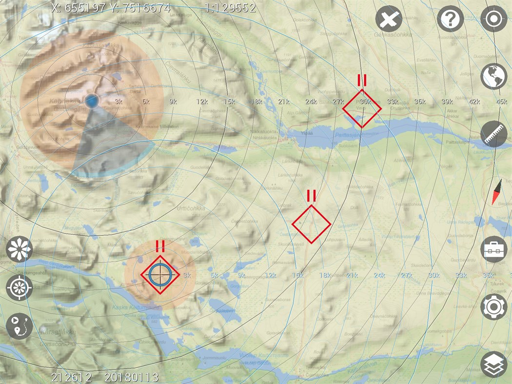
- Pan to projected or geographic coordinate (x,y or lat,long)
- Display distance circles around current GPS position
- Display distance circles around cursor position
- Display proximity circles around current GPS position and around cursor position
- Measure raster values
- Copy coordinate for cursor position to clip board
- Quickly alternate layers
- Local backup of vector data
- Energy save mode
- Toolbox functions:
Distribute sample plots within polygons and along lines
The in app purchase "Unlock Walter Maps Pro" terms of use can be found at: http://waltermaps.com/walter_maps_ppm_terms_of_use/
Screenshots
What's new
- Version: PC
- Updated:
Price
-
*In-App Purchases - Today: Free
- Minimum: Free
- Maximum: Free
Track prices
Developer
- Dianthus AB
- Platforms: Windows Apps (1)
- Lists: 0 + 0
- Points: 0 + 2 ¡
- Rankings: 0
- Reviews: 0
- Discounts: 0
- Videos: 0
- RSS: Subscribe
Points
Not found ☹️
Rankings
Not found ☹️
Lists
Not found ☹️
Reviews
Be the first to review!
Additional Information
- Category:
Windows Apps›Navigation & Maps - OS:
HoloLens,Mobile,PC,Surface Hub - Size:
17 Mb - Supported Languages:
English - Content Rating:
EVERYONE - Windows Store Rating:
3.0(2) - Updated:
- Release Date:
Contacts
- Website:
 http://waltermaps.com
You may also like
-
- Maps for Gmaps
- Windows Apps: Navigation & Maps By: Rushi
- * Free
- Lists: 1 + 0 Rankings: 0 Reviews: 0
- Points: 0 + 44 Version: PC Our version of Gmaps 8 is the client of Top-Rated app on other platforms that is google map.Gmaps 8 can be used for finding places and directions. ** This is an unofficial client of ...
-
- Windows Maps
- Windows Apps: Navigation & Maps By: Microsoft Corporation
- Free
- Lists: 5 + 1 Rankings: 0 Reviews: 0
- Points: 5 + 38,996 Version: PC Maps is your guide to everywhere. Find your way with voice navigation and driving, transit, and walking directions. Search for places to get directions, business info, and reviews. ...
-
- i-Hunting: Gps Maps w/ Property Lines, Topos & Trails
- Windows Apps: Navigation & Maps By: Bist LLC
- * Free
- Lists: 0 + 0 Rankings: 0 Reviews: 0
- Points: 0 + 25 Version: PC This hunting GPS app provides access to property line maps, parcels & public lands, land ownership details. Map layers for 50+ states include hunting zones, restricted areas, possible ...
-
- Open with Maps
- Windows Apps: Navigation & Maps By: ayamadori
- * Free
- Lists: 1 + 0 Rankings: 0 Reviews: 0
- Points: 2 + 50 Version: PC A simple complement(helper) for the Windows Maps app. ** You can buy Donation to support me, thanks! ** ## Feature - Open URL of map service (e.g. Place, Search, Route of Google Maps) ...
-
- WinGo Maps
- Windows Apps: Navigation & Maps By: Mah Studios
- $2.99
- Lists: 0 + 0 Rankings: 0 Reviews: 0
- Points: 0 + 17 Version: PC WinGo Maps is an Unofficial Google Map open source client for Windows 10 developed by MahStudio. This app made for Windows 10 devices family (PC, HoloLens, XBOX, Mobile and etc.) and ...
-
- Yandex.Maps
- Windows Apps: Navigation & Maps By: Yandex
- Free
- Lists: 1 + 1 Rankings: 0 Reviews: 0
- Points: 0 + 58 Version: PC Updated version for Windows 10 · World map · City guides · Walking directions · Directions for driving and public transportation · Real-time public transportation on the map · ...
-
- Mapy.cz
- Windows Apps: Navigation & Maps By: Seznam.cz a.s.
- Free
- Lists: 0 + 0 Rankings: 0 Reviews: 0
- Points: 1 + 37 Version: PC Mapy.cz by Seznam will lead you through the whole world. You can take your device anywhere in the world with you. Thanks to the tourist map you know about every trail and bike trail ...
-
- TravellerMap
- Windows Apps: Navigation & Maps By: NortherlyWind
- Free
- Lists: 0 + 0 Rankings: 0 Reviews: 0
- Points: 0 + 3 Version: PC The application for navigation on the offroad to global topographic map. Available map layers: Open Street Map (OSM) This application lets you use the cards the way you are accustomed ...
-
- Map Mania
- Windows Apps: Navigation & Maps By: LocalJoost
- $0.99
- Lists: 0 + 0 Rankings: 0 Reviews: 0
- Points: 1 + 4 Version: PC Map Mania allows you to view the world in all kinds of different ways. Bing Maps, Openstreetmap and Google maps are built in, but you can also add your own maps entering an URL from ...
-
- OneAppAway
- Windows Apps: Navigation & Maps By: Alex Kvenvolden
- $2.99
- Lists: 0 + 0 Rankings: 0 Reviews: 0
- Points: 0 + 5 Version: PC OneAppAway is a Windows 10 client for OneBusAway that has additional features. This app works on Windows 10 PCs and phones. In addition to most of the features of the official ...
-
- MapCortex - Free Edition
- Windows Apps: Navigation & Maps By: Tamas Balazs
- Free
- Lists: 0 + 0 Rankings: 0 Reviews: 0
- Points: 0 + 2 Version: PC Draw on a street map, on satellite imagery or even on National Geographic maps! Is this even possible? The answer is yes, with MapCortex Free Edition you can not only create complex ...
-
- PoiViewer10
- Windows Apps: Navigation & Maps By: Bjorn Holmstedt
- * Free
- Lists: 0 + 0 Rankings: 0 Reviews: 0
- Points: 0 + 115 Version: PC This program can open files with your Point Of Interests and present them on map. You can open files from the disk or SD card or from any other file source as downloaded from Internet ...
-
- 7ways
- Windows Apps: Navigation & Maps By: Registration Center
- * Free
- Lists: 0 + 0 Rankings: 0 Reviews: 0
- Points: 0 + 34 Version: PC Navigation application "7 Ways" Supports GPS and GLONASS Have you ever used a navigation which is clear and accessible? Then this software is for you! "We made this application for ...
-
- GPS-GPX Logger Pro
- Windows Apps: Navigation & Maps By: Ben Byer
- $0.99
- Lists: 0 + 0 Rankings: 0 Reviews: 0
- Points: 0 + 5 Version: PC New! Additional language support. Currently supports Chinese, Dutch, English, French, German, Italian, Polish, Russian and Spanish A great mapping and trip logging app. Uses the ...