| Developer: | Navimatics Corporation (3) | ||
| Price: | Free | ||
| Rankings: | 0 | ||
| Reviews: | 0 Write a Review | ||
| Lists: | 0 + 0 | ||
| Points: | 1 + 0 ¡ | ||
| Points + 1 | |||
Description
")
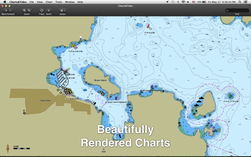
Charts&Tides was designed with ease of use in mind. The interface is intuitive and tasks have been streamlined. Unlike other marine software, you no longer need to download, store and manage individual charts or load them into the software; we have done the legwork for you and compiled large area charts that combine information from multiple sources.
In more detail:
- Provides continuous and seamless large area charts derived from NOAA and CHS vector cartography.
- Shows tide levels and current speeds on the chart using easily interpreted icons. Allows you to judge the water situation around you with a single glance.
- Integrates with the ActiveCaptain interactive cruising guidebook providing you with access to thousands of marinas, anchorages, hazards and other local knowledge.
- Stores the entire ActiveCaptain database offline so that it is always available to you, even without an Internet connection.
- Allows you to instantly search thousands of chart features and the ActiveCaptain database.
- Supports waypoints, routes, tracks and allows you to import and export them in GPX format.
- Supports GPS devices that transmit in the NMEA 0183 or GPSD format. Route navigation with automatic waypoint sequencing is supported.
- Supports AIS devices and Closest Point of Approach (CPA) computations and alerts, including spoken alerts. Set the CPA and TCPA and hear the computer speak the alerts to you!
- Comes with a dark UI that looks good during the day and will preserve your night vision when it is dark.
The software comes with a world base map, but does not come prepackaged with any detailed marine charts. You can purchase detailed marine charts from within the application. You can also use the software without purchasing additional charts.
Screenshots


What's new
- Version: 1.3.15159
- Updated:
- - Updated for OS X Yosemite
- Misc other fixes
Price
- Today: Free
- Minimum: Free
- Maximum: Free
Track prices
Developer
- Navimatics Corporation
- Platforms: iOS Apps (2) macOS Apps (1)
- Lists: 0 + 0
- Points: 1 + 20 ¡
- Rankings: 0
- Reviews: 0
- Discounts: 0
- Videos: 0
- RSS: Subscribe
Points

Rankings
Not found ☹️
Lists
Not found ☹️
Reviews
Be the first to review!
Additional Information
- Category:
macOS Apps›Travel - OS:
macOS,macOS 10.8 and up - Size:
29 Mb - Supported Languages:
English - Content Rating:
4+ - Mac App Store Rating:
0 - Updated:
- Release Date:
Contacts
You may also like
-
- NavLink US
- macOS Apps: Travel By: DigitalYacht Ltd.
- $29.99
- Lists: 0 + 0 Rankings: 0 Reviews: 0
- Points: 0 + 0 Version: 2.4 NavLink allows you to explore and plan your boating trips on your Mac at home or to use your Mac on the boat, as a fully functional electronic charting system, navigating in real time ...
-
- AngelPilot
- macOS Apps: Travel By: SailTrack Limited
- $19.99
- Lists: 0 + 0 Rankings: 0 Reviews: 0
- Points: 0 + 0 Version: 1.2.0 AngelPilot facilitates the use of charts and satellite imagery to assist the small boat navigator with pilotage. It has two key components: 1. A chart plotter specifically designed for
-
- i-Boating : Marine Navigation
- macOS Apps: Travel By: Bist LLC
- * Free
- Lists: 1 + 0 Rankings: 0 Reviews: 0
- Points: 1 + 0 Version: 143.0.0 This App offers access to Marine Charts for USA,Canada,UK/Ireland,Germany,Netherlands/Holland & Europe Rivers (Danube,Drava,Rhein etc). Coverage includes NOAA marine vector ...
-
- GPS Tracks
- macOS Apps: Travel By: David Morneault
- * Free
- Lists: 2 + 1 Rankings: 0 Reviews: 0
- Points: 4 + 0 Version: 1.7.0 GPS Tracks for the Mac is one of the best apps for editing and creating routes on your Mac. Sync all of your saved tracks from GPS Tracks to the app for editing and reviewing. It's ...
-
- inRoute: Intelligent Routing
- macOS Apps: Travel By: Carob Apps, LLC
- * Free
- Lists: 1 + 0 Rankings: 0 Reviews: 0
- Points: 4 + 0 Version: 8.4.4 Plan optimal routes or chart your own course using weather, elevation, curves and more. Then navigate safely with voice-guided, turn-by-turn directions that automatically check your ...
-
- iCurrency - Currency Converter
- macOS Apps: Travel By: Roman Bogomolov
- * Free
- Lists: 0 + 0 Rankings: 0 Reviews: 0
- Points: 2 + 2 Version: 2.3.4 iCurrency is a comprehensive currency converter that offers support for over 160 currencies, exchange rates, and historical charts. With iCurrency, you can easily manage and track your
-
- GPX Viewer
- macOS Apps: Travel By: William Modesitt
- $0.99
- Lists: 0 + 0 Rankings: 0 Reviews: 0
- Points: 0 + 0 Version: 3.12.07 View GPS eXchange format (GPX) files on your Mac. GPX Viewer can view GPX files exported from many GPS devices and other apps such as our Road Trip Planner app. Note: with this app you
-
- Locman lite
- macOS Apps: Travel By: anton van oosten
- Free
- Lists: 0 + 0 Rankings: 0 Reviews: 0
- Points: 0 + 0 Version: 2.0 nautical navigation application for all kind of vessels. Uses free S57 nautical vector charts