| Developer: | Harald Meyer (59) | ||
| Price: | $5.99 | ||
| Rankings: | 0 | ||
| Reviews: | 0 Write a Review | ||
| Lists: | 1 + 0 | ||
| Points: | 0 + 6 ¡ | ||
| Points + 1 | |||
Description
")
Cartograph Maps 3 is available here: https://www.cartograph.eu/v3/
### Features ###
- User interface languages: Dutch, English, French, German, Italian, Russian, Spanish, Traditional Chinese.
- View Mapsforge offline vector maps (including v5 format).
- Full support for Mapsforge styling/render themes (including hillshading) and layers.
- Offline raster maps: Locus SQLite maps, MBTiles, TwoWays/CompeGPS RMAP*, Oruxmaps SQLite*.
- Online map support (including WMS - Web Map Service maps), e.g. OpenStreetMap, OpenCycleMap, OpenSeaMap, WikiMedia hillshading, etc.
- Import online maps easily from files: "http://www.cartograph.eu/help_onlinemapimport".
- Offline hillshading (from HGT elevation data).
- Offline relief shading.
- Offline slope maps (experimental).
- Contour lines (Mapsforge maps).
- Worldwide, free offline maps.
- Support for Mapsforge multi-maps (multiple .map files stitched into a single map).
- Night/day mode.
- GPS Track recording.
- Manual track drawing and editing.
- GPX import and export (basic KML/KMZ import support).
- Import of photos with EXIF tags as waypoints.
- Import of KMZ photo series.
- Import Google Maps POIs/Places using Google Takeout data export function.
- Upload tracks to Strava.com.
- Route altitude profile and elevation/slope visualization.
- Online route search.
- Live tracking and polling (using custom server, GPSies.com, or Cartograph server).
- Support for Mapsforge POIs, offline POI search, and dynamic POI loading.
- Scalable interface (e.g. to increase button sizes).
- Compass.
- Units: Celsius, Kelvin, Fahrenheit, metric, imperial, nautic.
- Decimal and degree coordinate modes.
- Supports Mapsforge multi-language maps and POIs.
- Map import: iOS 11 File Browser, Wifi upload, iTunes file sharing, internal download manager, and import using "Open in" from 3rd party apps like Safari, Chrome, DropBox, etc.
- Voice/sound alerts along routes and waypoints. *EXPERIMENTAL*
- WaterSupply.at drinking water sources.
- Customizable user interface color (dark, light, and colors) and size.
- 3D map snapshot view for an overview over the current map region.
* RMAP and Oruxmaps use various map projections and support is experimental. Please contact us if a map does not work so that we can add support for your projection.
Further information: http://www.cartograph.eu
Getting started: https://www.cartograph.eu/gettingstarted
Help&Tutorial: https://www.cartograph.eu/docs
Facebook: https://www.facebook.com/Cartograph.eu/
User manual: http://www.cartograph.eu/downloads/usermanual_en.pdf
YouTube how-to videos: https://www.youtube.com/watch?v=dn9EOg5h3yY&list=PLP8X6xYv-qCz46hplsfGLW1LNgywBZrTk
Please drop us a line if you have questions or feature requests: http://www.cartograph.eu/contact
### Maps ###
- Offline Map Downloader (https://www.tequnique.com/offlinemapdownloader)
- OpenAndroMaps.org: very good maps for outdoor activities.
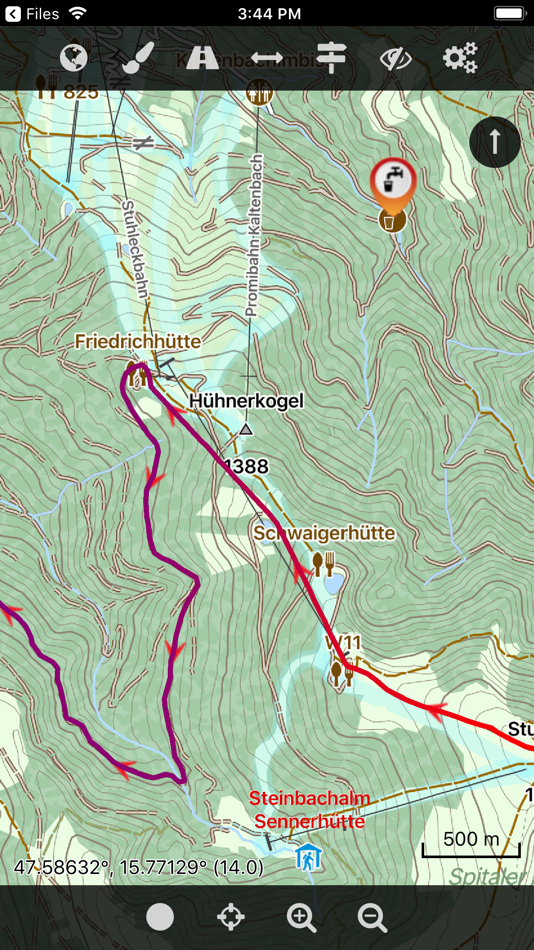
Screenshots


Video
What's new
- Version: 2.8.1
- Updated:
- ##---##
2.8.1 (11-05-2022)
##---##
- Cleaned up online maps.
Price
- Today: $5.99
- Minimum: $4.99
- Maximum: $5.99
Track prices
Developer
- Harald Meyer
- Platforms: iOS Apps (33) macOS Apps (26)
- Lists: 2 + 2
- Points: 5 + 919 ¡
- Rankings: 0
- Reviews: 0
- Discounts: 0
- Videos: 28
- RSS: Subscribe
Points
Not found ☹️
Rankings
Not found ☹️

Reviews
Be the first to review!
Additional Information
- Category:
iOS Apps›Navigation - OS:
iPad,iPhone,iOS 12.0 and up - Size:
46 Mb - Supported Languages:
English - Content Rating:
4+ - App Store Rating:
3.8(6) - Updated:
- Release Date:
Contacts
- Facebook: Cartograph.eu
You may also like
-
- 4WD Maps - Offline Topo Maps
- iOS Apps: Navigation By: Hema Maps
- $64.99
- Lists: 0 + 0 Rankings: 0 Reviews: 0
- Points: 0 + 4 Version: 2.4.2 Best value Hema App. The one-time cost includes all Hema 4WD maps, without any recurring subscriptions. Use offline mapping and your device s in-built GPS receiver to see where you are
-
- Maps 3D PRO - Hike & Bike
- iOS Apps: Navigation By: movingworld GmbH
- $3.99
- Lists: 1 + 4 Rankings: 0 Reviews: 0
- Points: 0 + 194 Version: 6.6 Enjoy exploring the great outdoors? If you re a fan of biking, hiking and running then Maps 3D is the ideal app designed for planning your outdoor adventures. Whereas other mapping ...
-
- Goose Maps for Watch
- iOS Apps: Navigation By: GOOSE MAPS LTD
- Free
- Lists: 0 + 0 Rankings: 0 Reviews: 0
- Points: 0 + 181 Version: 1.3 Features - Navigate easily everywhere Our pedestrian and bike navigation perfectly work even if your iPhone stayed at home. - Search objects you need Our search helps you to find ...
-
- Local Maps
- iOS Apps: Navigation By: Local Maps Inc
- Free
- Lists: 0 + 0 Rankings: 0 Reviews: 0
- Points: 0 + 4 Version: 1.3 Find the funnel cake stand or next horse race faster than ever before with this free and easy to use navigation platform for fairs and festivals. Start enjoying your time by finding ...
-
- Apple Maps
- iOS Apps: Navigation By: Apple
- Free
- Lists: 3 + 1 Rankings: 4 (1) Reviews: 0
- Points: 1 + 23,006 Version: 1.5 Maps Apple Maps is the best way to navigate and explore the world - all with your privacy protected. What s New: Multi-stop routing lets you add multiple stops along your driving route
-
- Google Maps
- iOS Apps: Navigation By: Google
- Free
- Lists: 13 + 6 Rankings: 5 (3) Reviews: 5 (1)
- Points: 5 + 5,879,662 Version: 6.113.0 Navigate your world faster and easier with Google Maps. Over 220 countries and territories mapped and hundreds of millions of businesses and places on the map. Get real-time GPS ...
-
- GPS Route Finder & Voice Maps
- iOS Apps: Navigation By: Mudassar Ahmed
- Free
- Lists: 0 + 0 Rankings: 0 Reviews: 0
- Points: 0 + 8 Version: 9.0 Get Turn by Turn GPS Driving Directions and Best Route to Your Destination with GPS Route Finder & Voice Maps Navigation App! GPS Route Finder & Voice MAPS is an easy to use GPS ...
-
- Bristol Maps
- iOS Apps: Navigation By: Chris Hager
- * Free
- Lists: 0 + 0 Rankings: 0 Reviews: 0
- Points: 0 + 2 Version: 2.05 Bristol Maps is designed specifically for commercial fishermen to navigate using the latest satellite imagery. Currently serving Bristol Bay and Copper River watersheds. Say goodbye to
-
- Wander: Maps & Navigation
- iOS Apps: Navigation By: Wander App Inc
- Free
- Lists: 0 + 0 Rankings: 0 Reviews: 0
- Points: 0 + 32 Version: 5.3.0 Wander is a global network of locally built maps. In the Wander App you'll find premium and official maps for large and small travel and recreation destinations. No more downloading an
-
- Yango Maps
- iOS Apps: Navigation By: Direct Cursus Computer Systems Trading
- Free
- Lists: 0 + 0 Rankings: 0 Reviews: 0
- Points: 0 + 102 Version: 18.0 Navigate the city easily, whether you're driving, walking, or using public transport. With our GPS-powered app, you can see your precise location and get convenient directions straight
-
- Petal Maps – GPS & Navigation
- iOS Apps: Navigation By: Huawei Software Technologies Co., Ltd.
- Free
- Lists: 0 + 0 Rankings: 0 Reviews: 0
- Points: 1 + 67 Version: 1.2.300 A new way to navigate Petal Maps lets you explore the world around you in new ways. Available in over 160 countries and regions, it not only lets you get your current location, browse ...
-
- York U Maps
- iOS Apps: Navigation By: YAN CHEN
- Free
- Lists: 1 + 0 Rankings: 0 Reviews: 0
- Points: 1 + 3 Version: 2.0 York U Maps is a navigation app for Keele campus of York University. You can search for buildings with their abbreviations, e.g. LAS for Lassonde Building, which are commonly used in ...
-
- Forest Maps 2
- iOS Apps: Navigation By: Kinnaman Software LLC
- Free
- Lists: 0 + 0 Rankings: 0 Reviews: 0
- Points: 0 + 476 Version: 2.7.2 Forest service maps on your iPhone or iPad! This app includes all areas mapped by the United States Forest Service. The map is a single, continuous map, so there's no need to search ...
-
- Avenza Maps: Offline Mapping
- iOS Apps: Navigation By: Avenza Systems Inc.
- * Free
- Lists: 0 + 0 Rankings: 0 Reviews: 0
- Points: 0 + 109,429 Version: 5.2.1 Avenza Maps, #1 app for hiking, biking and all trails. Featuring maps from National Geographic, national parks and more! On your next adventure, stay on track with GPS using offline ...