| Developer: | Agilest Solution (5) | ||
| Price: | * Free | ||
| Rankings: | 0 | ||
| Reviews: | 0 Write a Review | ||
| Lists: | 0 + 0 | ||
| Points: | 0 + 85 ¡ | ||
| Points + 1 | |||
Description
")
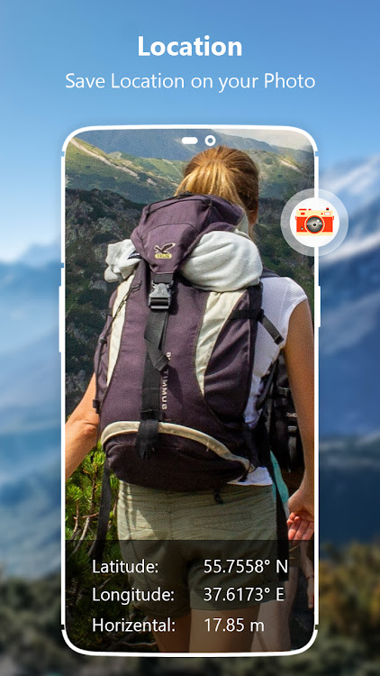
GPS Altimeter Altitude Compass is the best tracking Trekker, Hikers, Rock climbers and GlobeTrotters. While hiking gps or climbing, or while traveling with a car or bicycle, you can instantly discover your location and measuring altitude, direction, address infor, atmospheric pressure and geographic coordinates and adds this value to the photo. Discover my altitude for the places marked on the map. You can share the photos you take with your loved ones, including your altitude, address information and geographic coordinates. Digital Altimeter pro & GPS Altitude is a multipurpose app equipped with features like altimeter, barometer, inclinometer, level meter, GPS Map, compass over your satellite location. It works online & offline.
My elevation & altitudes app turns your smart phone into multi-function altimeter to get accurate altitude. Determine the altitude of your current location, exact heading on your current route or any place marked on the Map based on the GPS tracking.
Let us introduce you to key features of the app:
Accurate Altimeter Barometer App
Altimeter GPS is an accurate altitude meter app for height measurement above sea level that measures my current elevation, GPS location, Localization coordinates latitude and longitude. You can calibrate your altitude by refresh button. Measure the height of your traveling places and during hiking and record your Altitude history to share with images. No internet connection is required as it works even offline. If device is equipped with pressure sensor, then it can calculate accurate measurement of barometric pressure.
Save History of Altitudes
My altitude elevation changes at a high altitude above ground level. To measure and record the latest elevation/altitude and atmospheric pressure around you using Altimeter and Barometer, you can take pictures of yourself and save these altitude heights. Using this Altimeter barometer pressure app you can take photo at different air pressures and save all these elevation records in a map chart. Altimeter widget will provide you with all of these altimeter elevation images. It works offline and online and also saves Altitude history with charts.
All Map Modes with Localization Coordinates
My Altitude Altimeter app has GPS Map and Offline Map. Ultimate map tracking your changing location trajectory. This map has Terrain, Hybrid and Satellite mode to view your best map.
GPS Compass – Direction Map
Tap to view your accurate direction with this smart compass with gps for Android. Also you will find guidance with latitude and longitude. GPS map compass is the most accurate smart compass map app for outdoor activities like hilly areas and airplanes.
Bubble Level
Bubble level is plumb level tool also known as tilt meter, for precisely horizontally and vertical labelling in fields such as carpentry and construction. This precise level meter displays the data as accurate real level meter would.
Enjoy with this altimeter app!
Thank You for Your Support & Cooperation!
Screenshots


What's new
- Version: 1.0.7
- Updated:
Price
-
*Contains Ads - Today: Free
- Minimum: Free
- Maximum: Free
Track prices
Developer
- Agilest Solution
- Platforms: Android Apps (5)
- Lists: 0 + 0
- Points: 0 + 199 ¡
- Rankings: 0
- Reviews: 0
- Discounts: 0
- Videos: 1
- RSS: Subscribe
Points
Not found ☹️
Rankings
Not found ☹️
Lists
Not found ☹️
Reviews
Be the first to review!
Additional Information
- Category:
Android Apps›Travel & Local - OS:
Android 6.0 and up - Size:
23 Mb - Content Rating:
Everyone - Google Play Rating:
2.8(85) - Updated:
- Release Date:
Contacts
You may also like
-
- GPS Altimeter - Altitude App
- Android Apps: Travel & Local By: Firehawk
- * * Free
- Lists: 0 + 0 Rankings: 0 Reviews: 0
- Points: 0 + 902 Version: 1.2.0 GPS Altimeter - Altitude App is an advanced tool designed for outdoor enthusiasts, hikers, and professionals who require accurate altimeter and location information. This GPS altitude ...
-
- GPS Navigation Live Map Road
- Android Apps: Travel & Local By: Map Zone Studio
- * * Free
- Lists: 0 + 0 Rankings: 0 Reviews: 0
- Points: 0 + 28,948 Version: 4.1.6 Discover seamless exploration with the ultimate GPS Navigation & Map Direction App. This lightweight free navigation app helps you find the shortest route to your destination, avoid ...
-
- GPS Navigation Earth Map
- Android Apps: Travel & Local By: Infinite Translate
- * Free
- Lists: 0 + 0 Rankings: 0 Reviews: 0
- Points: 0 + 142 Version: 1.9 GPS navigation live earth map is uses GPS satellite signals to determine the current location of a device or user, and provides driving directions or routes to reach a particular ...
-
- GPS on ski map
- Android Apps: Travel & Local By: Maprika
- Free
- Lists: 0 + 0 Rankings: 0 Reviews: 0
- Points: 0 + 1,225 Version: New Maprika is the best mapping solution for ski resorts, parks, and campuses. Maprika uses GPS to put a "You are here" sign on "paper" maps, just like the ones you get at ski resort ...
-
- Altimeter GPS Meter Altitude
- Android Apps: Travel & Local By: Vivid App Tech
- * * Free
- Lists: 0 + 0 Rankings: 0 Reviews: 0
- Points: 0 + 4,066 Version: 1.4.6 Altimeter is useful in hiking, running, cycling, aviation and mountaineering purposes to measure altitude. The Altitude meter app has a unique GPS altimeter and current elevation ...
-
- Map of Paris offline
- Android Apps: Travel & Local By: Map Apps
- * * Free
- Lists: 0 + 0 Rankings: 0 Reviews: 0
- Points: 0 + 2,948 Version: 4.9 Map of Paris offline works without connecting to the Internet. No need to pay for internet in roaming. Benefits Map of Paris offline: - Ease of Use - Highly detailed maps are adapted ...
-
- GPS Map Camera Geotag Location
- Android Apps: Travel & Local By: Tools Village - GPS_Map_Camera, GPS_Speedometer
- * * Free
- Lists: 0 + 0 Rankings: 0 Reviews: 0
- Points: 0 + 2,918 Version: 1.83 Auto GPS Map Camera is here to Add Geotag Location on Photos. Track your current GPS Location, save it and even share. It has become easy with this gps camera location Application & ...
-
- Altimeter Mountain GPS Tracker
- Android Apps: Travel & Local By: Mystic Mobile Apps GPS Tools
- * * Free
- Lists: 0 + 0 Rankings: 0 Reviews: 0
- Points: 0 + 500 Version: 5.0.6 Turn your smartphone into a multi-functioned altimeter. Our unique algorithms determine your elevation using three sources - the GPS system in your phone, network services, and when ...
-
- Live GPS Satellite - Earth Map
- Android Apps: Travel & Local By: Apps Xperts
- * Free
- Lists: 0 + 0 Rankings: 0 Reviews: 0
- Points: 0 + 1,595 Version: 2.1.2 Live GPS Route Traffic finder is free navigation tour & trips app combined with real time traffic flow and weather information for travelers across the world. Satellite view street ...
-
- Street View Map Navigation App
- Android Apps: Travel & Local By: GPS Driving Studio
- * * Free
- Lists: 0 + 0 Rankings: 0 Reviews: 0
- Points: 0 + 335 Version: 1.2.6 Street View Map Directions App Navigate easy and fast Driving Directions of your desired routes with voice navigation. You can find Street View of famous places with directions, ...
-
- Satellite Map Live Navigation
- Android Apps: Travel & Local By: GPS Driving & Voice Navigation Apps
- Free
- Lists: 0 + 0 Rankings: 0 Reviews: 0
- Points: 0 + 362 Version: 2.4.0 Satellite Map Live Navigation helps users find the best route and distance between two locations. With Live Satellite Map Location Tracking, the GPS Live Navigation Map app ...
-
- GPS Navigation, Route Finder
- Android Apps: Travel & Local By: Epic Apps Studio
- * * Free
- Lists: 0 + 0 Rankings: 0 Reviews: 0
- Points: 1 + 819 Version: 7.3 Here we go with the accurate GPS HUD Speedometer. We have created this GPS HUD Navigation app with an intent to be the most useful tool for your car or bike. The Heads up Display (HUD)
-
- Map.md - map of Moldova
- Android Apps: Travel & Local By: Simpals SRL
- Free
- Lists: 0 + 0 Rankings: 0 Reviews: 0
- Points: 0 + 3,985 Version: 9.0 Map.md is a vector map of Moldova, which includes a detailed catalogue of places and institutions, easy and simple search system, comfortable navigation and public transport routes. ...
-
- GPS Navigation: Live Earth Map
- Android Apps: Travel & Local By: Tap Apps Studio
- * Free
- Lists: 0 + 0 Rankings: 0 Reviews: 0
- Points: 0 + 7,187 Version: 1.7.9 GPS Navigation Live Street Map and Driving Direction allow you to make driving route on world map. With GPS navigation app & street view maps helps you to visit any famous place of ...