| Developer: | SkyCharts LLC (5) | ||
| Price: | * * Free | ||
| Rankings: | 0 | ||
| Reviews: | 0 Write a Review | ||
| Lists: | 0 + 0 | ||
| Points: | 0 + 87 ¡ | ||
| Points + 1 | |||
Description
")
Due to no freely avialable charts, please note that for charts outside of USA&Brazil non current ONC/VFR with a current openAIP overlay is available, but NO IFR charts or plates are available.
Includes a free 30 day trial!
If you wish to continue using SkyCharts after the trial, please purchase a $3.99/month subscription. Note that buying a subscription does not unlock any additional features.
For USA/Alaska, the application has all current FAA VFR (sectional+WAC), IFR (High and Low), TAC, FLY (flip side of TAC chart), Helicopter, Gulf Coast WAC, Gulf Of Mexico, and Wall aviation charts.
Grand Canyon charts are included in the TAC charts, and Bahamas and Mexico as WAC charts.
Brazil has VFR, IFR (High and Low) and approach plates.
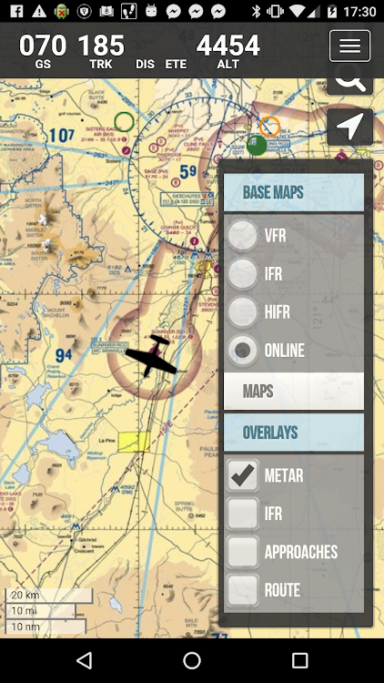
Also included is a METAR/TAF overlay, and an IFR overlay to view routes on top of VFR charts.
Its very easy to create and modify routes directly on the map or by drag&drop in table.
Navigation readout is configurable to fit exactly what you want to see. It also has a nifty auto-layout feature that selects fields for you in both portrait and landscape mode.
DOUBLE TAP on map to view A/FD and approach plates.
Map has VFR/IFR/LIFR color-coded weather METARs, with orange TAFs.
SUA (Special Use Airspace) information is also available.
Download charts and plates for offline usage.
Features:
* Fast zoom/scroll of included charts using standard gestures.
* Allows download of charts for offline usage. Charts are selected on a region basis.
* Navigation computes GS, TRK, DTK, DIS & ETE to final waypoint.
* METAR/TAF color coded dots according to ADDS: http://www.skycharts.net/?page_id=421
* Double tap on airport to select A/FD and TPPs/IAPs to view.
* Huge built-in navigation database, with all 20,000 airports, 45,000 FAA IFR/VFR navigation fixes and 2,100 FAA VOR/ADF fixes.
For more information, please see the webpage at
http://www.skycharts.net
The monthly subscription of SkyCharts XC aviation data of $3.99 is auto-renewed. Payment will be charged to your Google Play Store account at confirmation of purchase. You can turn off auto-renew at any time from your Google Play Store account settings, but you must do so at least 24 hours before the end of the current subscription period to avoid being billed for the next cycle. No cancellation of the current subscription is allowed during the active period. Any unused portion of a free trial period will be forfeited when you purchase a subscription to SkyCharts XC.
The privacy policy and EULA can be found here:
http://www.skycharts.net/?page_id=1465
For fast response to all questions, comments or suggestions, please email support@skycharts.net
Screenshots


What's new
- Version: 5.5.0
- Updated:
Price
-
*Contains Ads*In-App Purchases - Today: Free
- Minimum: Free
- Maximum: Free
Track prices
Developer
- SkyCharts LLC
- Platforms: Android Apps (2) iOS Apps (3)
- Lists: 0 + 0
- Points: 0 + 107 ¡
- Rankings: 0
- Reviews: 0
- Discounts: 0
- Videos: 0
- RSS: Subscribe
Points
Not found ☹️
Rankings
Not found ☹️
Lists
Not found ☹️
Reviews
Be the first to review!
Additional Information
- Category:
Android Apps›Maps & Navigation - OS:
Android 5.0 and up - Size:
21 Mb - Content Rating:
Everyone - Google Play Rating:
3.5(87) - Updated:
- Release Date:
Contacts
- Website:
 http://www.skycharts.net
You may also like
-
- Geo Measure Area calculator
- Android Apps: Maps & Navigation By: MORO Apps
- * Free
- Lists: 0 + 0 Rankings: 0 Reviews: 0
- Points: 0 + 666 Version: New Geo Measure is the best free tool when you want to purchase some property, and want to calculate area of that property. Geo Measure will help you like your best friends and will give ...
-
- Geo: Convert GPS Coordinates
- Android Apps: Maps & Navigation By: Qvyshift LLC
- * * Free
- Lists: 0 + 0 Rankings: 0 Reviews: 0
- Points: 0 + 972 Version: 4.5.1 Find your current GPS coordinates and easily convert GPS location coordinates into a different format. Latitude/longitude (decimal degrees) Latitude/longitude (degrees-minutes-seconds)
-
- NV Charts GPS Navigation AIS
- Android Apps: Maps & Navigation By: NV CHARTS
- * Free
- Lists: 0 + 0 Rankings: 0 Reviews: 0
- Points: 0 + 1,783 Version: 2.714.192 The NV Charts navigation app with an intuitive interface and powerful tools is a must-have for onboard navigation while cruising, fishing, sailing, diving or any other activity on the ...
-
- AvNav EFB
- Android Apps: Maps & Navigation By: AvNav, LLC
- Free
- Lists: 0 + 0 Rankings: 0 Reviews: 0
- Points: 0 + 333 Version: 5.2.5-prod The Most Advanced Flight Planning and Navigation App for Pilots on Android. AvNav is for pilots who enjoy local and cross country flying through variety of terrain and weather ...
-
- Approach Charts
- Android Apps: Maps & Navigation By: BBFlight LLC
- * Free
- Lists: 0 + 0 Rankings: 0 Reviews: 0
- Points: 1 + 53 Version: 2.6.0 FAA Instrument Approach charts (Terminal Procedures) for the US - Includes Airport diagrams, Minimums, STARS and DPs - Search by airport name, city, state or identifier - Quick access ...
-
- UTM Geo Map
- Android Apps: Maps & Navigation By: Y2 Tech
- * * Free
- Lists: 0 + 0 Rankings: 0 Reviews: 0
- Points: 1 + 15,719 Version: 4.0.2 Complete, simple, easy to use & free application for Land Surveying, Topography, Bathymetry & GIS. Suitable for Geodesy Engineering, Civil Engineering, Geology and other disciplines ...
-
- Navigraph Charts
- Android Apps: Maps & Navigation By: Navigraph
- Free
- Lists: 0 + 0 Rankings: 0 Reviews: 0
- Points: 0 + 1,214 Version: 8.33.1 Looking for the most comprehensive software solution for flight simulation? Navigraph Charts is your co-pilot. Navigraph Charts 8 has been developed with emphasis on delivering a ...
-
- Orca - Boating, Charts, Routes
- Android Apps: Maps & Navigation By: Orca Technologies AS
- * Free
- Lists: 0 + 0 Rankings: 0 Reviews: 0
- Points: 0 + 545 Version: 1.0.145 Better boating with Orca. Find your destination with accurate marine charts. Get tailor-made route proposals. View flexible instruments, control your autopilot, and stay informed of ...
-
- Wisconsin Lakes GPS Charts
- Android Apps: Maps & Navigation By: FLYTOMAP INC
- * $3.99
- Lists: 0 + 0 Rankings: 0 Reviews: 0
- Points: 0 + 5 Version: 4.4.3.7 Flytomap is a valid and interesting alternative, Worldwide Marine and Outdoor Maps available when connected, thanks to viewer.flytomap.com Worldwide Satellite images overlay on charts ...
-
- skybro Digital Sky
- Android Apps: Maps & Navigation By: skybro
- Free
- Lists: 0 + 0 Rankings: 0 Reviews: 0
- Points: 0 + 5 Version: 1.4 skybro Digital Sky is for all general aviation enthusiasts. No matter if you fly a plane / glider / paraglider or operate drones the app helps you in reaching destinations in a safer, ...
-
- Avia Maps Aeronautical Charts
- Android Apps: Maps & Navigation By: Remy Webservices UG
- * Free
- Lists: 0 + 0 Rankings: 0 Reviews: 0
- Points: 0 + 1,674 Version: 3.12.2 The reliable and straightforward aviation maps for pilots and aerospace enthusiasts around the world. The app is suited for pre-flight planning as well as in-flight navigation. Simply ...
-
- SkyRouter Asset Management
- Android Apps: Maps & Navigation By: Blue Sky Network, LLC
- Free
- Lists: 0 + 0 Rankings: 0 Reviews: 0
- Points: 0 + 45 Version: New Blue Sky Network s products combine cutting-edge technologies with our powerful cloud-base web portal, SkyRouter, to deliver industry-leading capabilities. SkyRouter application ...
-
- Live Satellite View: Earth Map
- Android Apps: Maps & Navigation By: Blue Sky Apps Valley
- * Free
- Lists: 0 + 0 Rankings: 0 Reviews: 0
- Points: 0 + 708 Version: 1.2.1 Live Satellite View is GPS Navigation app for everyone to route planner. This live earth map to track any gps location in a short time for your plan. You can navigate two GPS location ...
-
- Gps Area Calculator
- Android Apps: Maps & Navigation By: KBK INFOSOFT
- * Free
- Lists: 0 + 0 Rankings: 0 Reviews: 0
- Points: 0 + 29,287 Version: 27.0 Fields area Measure is a smart tool for measuring areas on the map. Once you place your points on the map and then calculate area between all point. you can also calculate total Area ...