| Entwickler: | Mapillary (1) | ||
| Preis: | Kostenlos | ||
| Klassifizierungen: | 0 | ||
| Rezensionen: | 0 Rezension schreiben | ||
| Listen: | 0 + 0 | ||
| Punkte: | 0 + 656 ¡ | ||
| Punkte + 1 | |||
Beschreibung
")
Anyone can capture images of any place, as often as needed, with any camera—including smartphones. Mapillary combines all images into a collaborative street-level view of the world that’s available for anyone to explore and use for improving maps, cities, and mobility. Computer vision technology provides a smooth viewing experience and speeds up mapping through machine-extracted map data.
Capturing with the Mapillary mobile app is the easiest way to join our contributor network. Let’s get started!
CREATE YOUR OWN STREET-LEVEL VIEWS
You control when and where to capture to create the freshest street-level imagery. Mapillary’s technology combines all images into a navigable view and blurs faces and license plates for privacy.
ACCESS AND OPEN UP DATA
Mapillary contributors are people, organizations, companies, and governments in 190 countries. Millions of images are added to the dataset every week, which you can explore right here in the mobile app.
MAKE BETTER MAPS
Use imagery and machine-extracted data to add details to maps and geospatial datasets. Mapillary integrates with tools like OpenStreetMap iD editor and JOSM, HERE Map Creator, and ArcGIS. To access the available map data, go to mapillary.com/app.
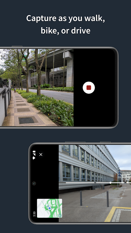
Screenshots


Video
Neue Funktionen
- Version: 2024.03.22-6.2.37
- Aktualisiert:
- Updates:
- Image reporting functionality.
- MapLibre used as a map’s engine.
- Permission requests are shown at the exact moment when you need them.
- Removed the excessive old design dependencies.
- Restricted areas are visible on the camera’s map.
Addressed issues:
- Crash on Pixel 3
- Crash on deleting last image.
- Crash on browsing the map.
- Misplaced start-end date for captures in processing.
Preis
- Heute: Kostenlos
- Mindestens: Kostenlos
- Maximale: Kostenlos
Preise beobachten
Entwickler
- Mapillary
- Plattformen: Android Apps (1)
- Listen: 0 + 0
- Punkte: 0 + 656 ¡
- Klassifizierungen: 0
- Rezensionen: 0
- Rabatte: 0
- Videos: 1
- RSS: Abonnieren
Punkte
Nicht gefunden ☹️
Klassifizierungen
Nicht gefunden ☹️
Listen
Nicht gefunden ☹️
Rezensionen
Schreiben Sie die erste Bewertung!
Weitere informationen
- Kategorie:
Android Apps›Karten & Navigation - Betriebssysteme:
Android 7.0 oder höher - Größe:
24 Mb - Altersfreigabe:
Everyone - Google Play Bewertung:
3.8(656) - Aktualisiert:
- Veröffentlichungsdatum:
Kontakte
- Webseite:
 https://www.mapillary.com
Das könnte Ihnen auch gefallen
-
- Uploader To Mapillary
- Android Apps: Tools Von: Studio Z81
- Kostenlos
- Listen: 0 + 0 Klassifizierungen: 0 Rezensionen: 0
- Punkte: 0 + 0 Version: New This application allows you to solve some of the limitations of the native Mapillary application: - if native application does not save direction tag in your phone. - you want to use ...
- -50%
- OsmAnd+ — Maps & GPS Offline
- Android Apps: Reisen & Lokales Von: OsmAnd
- * $19.99
$39.99-50% - Listen: 7 + 5 Klassifizierungen: 0 Rezensionen: 0
- Punkte: 8 + 38,496 Version: 4.7.10 OsmAnd+ is an offline world map application based on OpenStreetMap (OSM), which allows you to navigate taking into account the preferred roads and vehicle dimensions. Plan routes based
Das könnte Ihnen auch gefallen
- Android Apps
- Neu Android Apps
- Karten & Navigation Android Apps : Neu
- Videos Android Apps
- Beliebt Android Apps
- Karten & Navigation Android Apps : Beliebt
- Rabatte Android Apps
- Karten & Navigation Android Apps : Rabatte
- Klassifizierungen Android Apps
- Rezensionen Android Apps
- Listen Android Apps
- Punkte Android Apps