| Developer: | FLYTOMAP INC (337) | ||
| Price: | $3.99 | ||
| Rankings: | 0 | ||
| Reviews: | 0 Write a Review | ||
| Lists: | 0 + 0 | ||
| Points: | 0 + 0 ¡ | ||
| Points + 1 | |||
Description
")
Featured on the Deck
Featured on Geomedia
Worldwide Marine and Outdoor Maps available when connected, thanks to viewer.flytomap.com
Worldwide Satellite images overlay on charts
Worldwide Terrain features overlay on charts, thanks to Open Street Map, Open Cycle Map, Earth,GoogleMap,topo maps by ESRI
Now with NOAA raster charts seamless with continuous updates from the official Government server
Now with ActiveCaptain - Worldwide boaters community * 200.000 + Captains
Use to Explore:
√ Latitudes and Longitudes to go to your favorite places
√ Search your Favorite points directly
√ Zoom, Rotate and Pan fast just by a finger touch
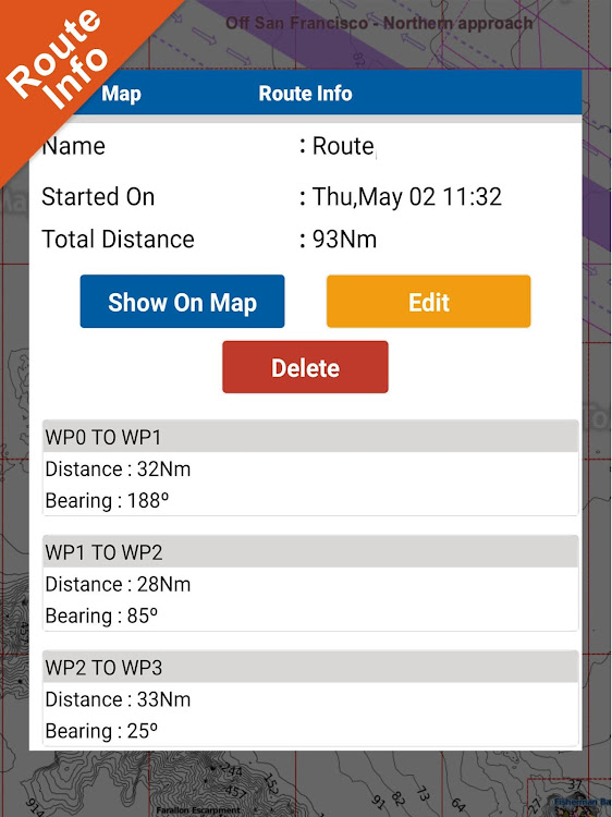
√ Route with unlimited waypoints
√ With Head Up and Course Up feature
√ Geocompass
√ Navigate and see your GPS position on the map
√ Heading Vector Towards the direction movement
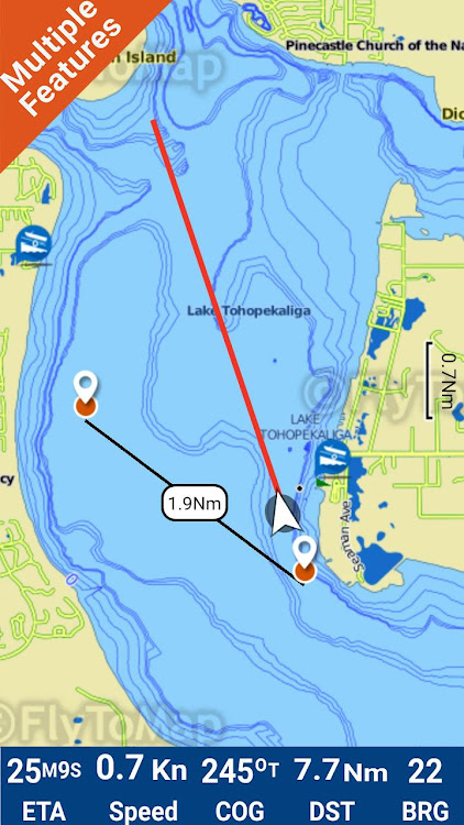
√ Distance Measurement Tool to easily calculate the distance from one location to another
√ Insert the target/destination and see in real time your speed, distance and bearing
√ background mode - Flytomap works in background as well, you can swap with another app and receive/make calls send sms while panning and zooming.
√ Unlimited Tracks share via email, visible on Google, Flytomap Viewer, KMZ format - Store your track without the need of cellular data or mobile signal
√ KMZ KML from / to GPX Converter
√ Optimized battery usage
√ ActiveCaptain
• View and contribute to the best boaters community available in the world
• Continuous update of all info (including reviews from the deck) about :
• Marinas
• Anchorages
• Hazards
• Local Knowledge
√ And so much more to come - It’s the only app you will ever need! Our charts are installed on: GARMIN NAVICO LOWRANCE B&G NORTHSTAR EAGLE SIMRAD
Follow us:
▶Twitter @flytomap
▶Web Site flytomap.com
▶Web App viewer.flytomap.com
▶Facebook facebook.com/flytomap
The cartography of Lake Tohopekaliga is included in this application
Flytomap is committed to constant improvement, this App is developed with the help of professional boaters to get the best experience on the sea, we listen to our users and systematically add the most requested features.
Thank you for the feedback!
Additional info about Flytomap products
FLYTOMAP LAKE MAPS:
We offer high quality lake maps with detailed information and important features compressed to assure the larger coverage in USA region. Lake maps contain most important DNR lakes with detailed ‘Depth Contours, Boat Ramps, Fishing spots etc. Also includes Trails, Roads and Railways information.
WATER MAPS (Marine):
Water map navigator is the new ‘Marine Navigator for all mobile devices contains embedded Electronic Nautical Charts (ENC) from NOAA compressed to a large coverage.You can now download the application and transform your Phone in a chart plotter with best NOAA, ENC S57 cartography; which includes Anchoring areas, Fishing areas,restriction areas, obstructions, rocks, Buoys, Beacons, Lights, Depth contours with Values display on map, Spot Soundings and more. The only marine app’s available in the market with such huge information. Every effort is made to be as accurate as possible when presenting information for every destination.
TRAVEL MAPS:
These Maps treat you mostly with information of both Marine and terrain correspondingly. These are the most preferable Maps to travel especially for fascinating recreational voyages, map focus the best Beach spots along the Coast line, Major ports, Sailing, Fishing, Picnic areas, Parks, Hiking, Biking, Clubs, restaurants,Famous Hotels, Museums, Shopping areas, and much more. Introducing guide in map navigator for easy references, you can use it without any Active Internet connection!
“We work to delight your moments”
! Enjoy great Journeys!
Screenshots


What's new
- Version: 4.4.3.5
- Updated:
- 1 week Weather forecast
Marker list improved
GOTO function improved
Price
- Today: $3.99
- Minimum: $3.99
- Maximum: $3.99
Track prices
Developer
- FLYTOMAP INC
- Platforms: Android Apps (337)
- Lists: 0 + 0
- Points: 1 + 745 ¡
- Rankings: 0
- Reviews: 0
- Discounts: 0
- Videos: 0
- RSS: Subscribe
Points
Not found ☹️
Rankings
Not found ☹️
Lists
Not found ☹️
Reviews
Be the first to review!
Additional Information
- Category:
Android Apps›Maps & Navigation - OS:
Android 5.0 and up - Size:
59 Mb - Content Rating:
Everyone - Google Play Rating:
0 - Updated:
- Release Date:
Contacts
- X: flytomap
- Facebook: flytomap
- Website:
 http://flytomap.com
You may also like
-
- Lake Francis Case GPS Map
- Android Apps: Maps & Navigation By: FLYTOMAP INC
- * $3.99
- Lists: 0 + 0 Rankings: 0 Reviews: 0
- Points: 0 + 0 Version: 4.4.4.3 Flytomap is a valid and interesting alternative, Benetti Yachts Featured on the Deck Featured on Geomedia Worldwide Marine and Outdoor Maps available when connected, thanks to ...
-
- Lake Ellis - IOWA GPS Map
- Android Apps: Maps & Navigation By: FLYTOMAP
- * $3.49
- Lists: 0 + 0 Rankings: 0 Reviews: 0
- Points: 0 + 0 Version: 4.4.4.3 Flytomap is a valid and interesting alternative, Benetti Yachts Featured on the Deck Featured on Geomedia Worldwide Marine and Outdoor Maps available when connected, thanks to ...
-
- GPS Navigation Live Map Road
- Android Apps: Maps & Navigation By: GPS Map Navigation: English Grammar Learning Apps
- * Free
- Lists: 0 + 0 Rankings: 0 Reviews: 0
- Points: 0 + 0 Version: 1.3 Explore the whole world by the GPS navigation live map road app. Visit the live satellite view in real-time. 3d earth map app is using the GPS map to display all locations on your ...
-
- Street View GPS Map Navigation
- Android Apps: Maps & Navigation By: GPS & Map Navigation Tool
- Free
- Lists: 0 + 0 Rankings: 0 Reviews: 0
- Points: 0 + 0 Version: 1.1 Street View GPS Map Navigation application is a combination of World Earth Map, Live Satellite Map and Live Street View. However, access to live images of world famous places and the ...
-
- Lake Clark Offline Topo Map
- Android Apps: Maps & Navigation By: XDivide Geospatial
- $2.99
- Lists: 0 + 0 Rankings: 0 Reviews: 0
- Points: 0 + 0 Version: 1.0 Designed with simplicity in mind, this app offers an intuitive user interface that enables you to quickly and easily find information about surroundings, without any prior technical ...
-
- Lake Dardanelle AR Offline Map
- Android Apps: Maps & Navigation By: MAPITECH LTD
- $4.99
- Lists: 0 + 0 Rankings: 0 Reviews: 0
- Points: 0 + 0 Version: 5.2.1.2 MapiTech launches on the market the best official up-to-date RNC (raster) combined with S57 nautical charts (digital): marinas, wrecks, fishing spots, boat ramps, POI. This app ...
-
- GPS Land Field Area Measure
- Android Apps: Maps & Navigation By: GPS Map Camera
- * * Free
- Lists: 0 + 0 Rankings: 0 Reviews: 0
- Points: 0 + 559 Version: 1.1.6 Are you looking for an easy and convenient way to measure land area? Look no further than the GPS land field area measure app! With this measuring app, you can easily and quickly ...
-
- GPS Map: Live Satellite View
- Android Apps: Maps & Navigation By: Saima Apps
- * Free
- Lists: 0 + 0 Rankings: 0 Reviews: 0
- Points: 0 + 0 Version: 2.3 View the world Satellite Map location with GPS Map: Live Satellite View App. Get a realistic view of Street Map View and map on the same screen with zoom-in & zoom-out capability. ...
-
- GPS Map Coordinates Finder
- Android Apps: Maps & Navigation By: Breed Softech
- * * Free
- Lists: 0 + 0 Rankings: 0 Reviews: 0
- Points: 0 + 65 Version: 1.6 GPS Map Coordinates Finder is a user-friendly app that helps you quickly find your GPS coordinates, as well as the coordinates of any location on earth. This app is perfect for hikers,
-
- GPS Map Driving Directions
- Android Apps: Maps & Navigation By: Andro World Inc.
- * Free
- Lists: 0 + 0 Rankings: 0 Reviews: 0
- Points: 0 + 0 Version: 1.4 GPS Map Driving Directions & Traffics is a easy and simple maps directions app.Using Voice GPS Map Driving Directions & Traffics, you can find the shortest possible route and ...
-
- Gps map navigation compass
- Android Apps: Maps & Navigation By: BGC Studio
- * * Free
- Lists: 0 + 0 Rankings: 0 Reviews: 0
- Points: 0 + 246 Version: 1.5.1 GPS map navigation is a tool that uses GPS (Global Positioning System) technology to provide real-time guidance and directions to users. It is commonly accessed through mobile ...
-
- GPS Map Ruler-area measurement
- Android Apps: Maps & Navigation By: Power Star APPS
- * Free
- Lists: 0 + 0 Rankings: 0 Reviews: 0
- Points: 0 + 2,651 Version: 1.9.3 GPS Map Ruler is a map measurement app, functioning as a virtual map ruler, which can be used for distance measurement between two points, as well as for distance measurement among ...
-
- GPS Speedometer & Odometer APP
- Android Apps: Maps & Navigation By: Tools Village - GPS_Map_Camera, GPS_Speedometer
- * * Free
- Lists: 0 + 0 Rankings: 0 Reviews: 0
- Points: 0 + 0 Version: New Easy to use speedometer mph tracker GPS Speedometer is a powerful and easy-to-use app. GPS speedometer allows you to track your speed and distance covered while traveling. The ...
-
- GPS Map Navigation: 3D Map App
- Android Apps: Maps & Navigation By: Cupncode
- * Free
- Lists: 0 + 0 Rankings: 0 Reviews: 0
- Points: 0 + 0 Version: New A GPS map navigation app is a digital tool that provides users with a 3d map view of their surroundings and allows them to navigate to different destinations using their smartphone or ...