| ผู้พัฒนา: | Waymarked Trails LTD (5) | ||
| ราคา: | * ฟรี | ||
| การจัดอันดับ: | 0 | ||
| ความเห็น: | 0 เขียนความเห็น | ||
| รายการ: | 0 + 0 | ||
| แต้มแล: | 0 + 543 ¡ | ||
| แต้มแล + 1 | |||
คำอธิบาย
")
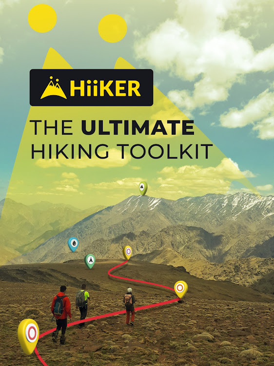
Here are some of the key features of HiiKER (expanded below)
* Discover over 87,000 verified hiking trails
* Find campsites, hotels, huts, stores, motels, water sources etc
* Plan your own custom hiking route
* Record your Hikes
* Download hiking trails for FREE to navigate offline
* Create custom waypoints for Nav and Geocaching
* Import & Export GPX files for Free
* Choose from High-Resolution Map layers
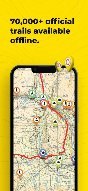
Download thousands of Hiking trail maps for FREE
With HiiKER, you can download over 87,000 of the world’s best hiking, walking and backpacking trails right to your smartphone for free. Looking for the perfect hiking trail? You’ll find the trail that’s right for you with our powerful trail search tool. And navigate it completely offline, for free.
Points of Interest / Accommodation
You’ll find thousands of accommodation and amenity options for your adventures. Plan ahead with the perfect lunch spot, campsite, resupply town or maybe even a 5-star hotel on your hiking trip.
Plan custom hiking routes
The HiiKER Route Planner will enable you to blaze your own trail and plan a custom hiking route. Download your planned hiking route to your device for free and navigate offline. You can even share your hiking route with others or with your smart device, like Garmin, Apple watch or Google Fit.
Free Offline Hiking Maps
With HiiKER you can download all your favourite trails to your phone to use offline FOR FREE - even in airplane mode, so you can stay safe on the trail.
Waypoints & Geocaching
Place custom waypoints on any map and edit the details of the waypoint. Waypoints can be used to note campsites, gps coordinates, geocache locations, checkpoints and many other uses.
Import GPX files
Got a GPX file from a friend or another app like alltrails, onx, gaia gps, garmin, strava, komoot? Import it to HiiKER and make your own edits to the route before hitting the trail.
Record your Hikes
The HiiKER Tracker records your hiking activity and gives you in-depth detail about your adventures that you can share to Strava, Garmin and with your hiking community.
High-Resolution Map layers
We are building the most comprehensive selection of FREE map layers available. You'll find the layer that is best suited to your hike. These include
Open street maps (OSM)
Satellite
Nature
Mobile Atlas
Landscape
Pioneer
Transport
Free GPX Download
Export GPX files of one of the thousands of hiking trails on HiiKER for FREE. Sync them with your other gps devices, such as Garmin, suunto, coros etc.
HiiKER PRO+ pricing starts from $4.99 per month or $49.99 per year.
[PRO+] Measure the Distance
Use our handy measurement tool to know what distance, terrain and elevation lie ahead.
[PRO+] Stage by stage breakdown
Planning a longer hike and want to divide the trail into smaller segments? Our stage-by-stage breakdown helps you plan your days better with clever distance and elevation management.
[PRO+] Premium High-Resolution maps
Upgrading to HiiKER PRO+ gets you access to some of the world's best map developers in the world on the platform. These high-resolution maps include
US National Forests
USGS
National Park Service
Ordnance Survey UK
EastWest Mapping
IGN
OSi (Ireland) / Tailte
Swiss Topo
All of these maps can be used in conjunction with other HiiKER features.
Quality Data
We don’t just put any trail on HiiKER. We partner with trail organisations, National parks and other trusted sources around the world to bring you the most up-to-date and official trail data available.
These organisations are critical to the enjoyment and safety of hikers. As many are voluntary or NFP organisations, we give users the ability to donate to them for the valuable work they do.
Help and Support
Contact us at customer-support@hiiker.co
Legal
Terms of Service: https://hiiker.app/terms-of-service
ภาพหน้าจอ


มีอะไรใหม่
- เวอร์ชัน: 5.17-525
- อัปเดต:
- Bug fixing
ราคา
-
*การซื้อภายในแอพ - วันนี้: ฟรี
- ต่ำสุด: ฟรี
- มากที่สุด: ฟรี
ติดตามราคา
ผู้พัฒนา
- Waymarked Trails LTD
- แพลตฟอร์ม: Android แอป (1) iOS แอป (4)
- รายการ: 0 + 0
- แต้มแล: 0 + 954 ¡
- การจัดอันดับ: 0
- ความเห็น: 0
- ลดราคา: 0
- วิดีโอ: 0
- RSS: ติดตาม
แต้มแล
ไม่พบ ☹️
การจัดอันดับ
ไม่พบ ☹️
รายการ
ไม่พบ ☹️
ความเห็น
แสดงรีวิวเป็นคนแรกเลย!
ข้อมูลเพิ่มเติม
- หมวดหมู่:
Android แอป›แผนที่และการนำทาง - ระบบปฏิบัติการ:
Android 8.0 และสูงกว่า - ขนาด:
26 Mb - การจัดประเภทเนื้อหา:
Everyone - Google Play คะแนนโดย:
3.9(543) - อัปเดต:
- วันที่วางจำหน่าย:
รายชื่อติดต่อ
- เว็บไซท์:
 https://hiiker.com
คุณอาจชอบ
-
- Offline Maps, GPS Directions
- Android แอป: แผนที่และการนำทาง โดย: AppStar Studios
- * ฟรี
- รายการ: 1 + 0 การจัดอันดับ: 0 ความเห็น: 0
- แต้มแล: 0 + 8,536 เวอร์ชัน: 4.7 Offline Maps offers GPS Navigation with Driving Directions and Real-Time Traffic Alerts. Best Offline Maps app with GPS Navigation, Driving Directions and Voice Navigation. It offers ...
-
- Offline Route Maps
- Android แอป: แผนที่และการนำทาง โดย: ShamiTech Apps
- * ฟรี
- รายการ: 0 + 0 การจัดอันดับ: 0 ความเห็น: 0
- แต้มแล: 0 + 893 เวอร์ชัน: 1.54 Offline Route Maps App will help you to search offline route, get the shortest path on map with offline route planner, find the location and get the route with voice directions on app ...
-
- Israel Hiking Map
- Android แอป: แผนที่และการนำทาง โดย: Israel Hiking
- * ฟรี
- รายการ: 0 + 0 การจัดอันดับ: 0 ความเห็น: 0
- แต้มแล: 0 + 254 เวอร์ชัน: 9.20.2 Israel Hiking Map is a powerful, yet simple to use, navigation and route-planning tool for the outdoors. Geared towards hikers, bikers and off-road drivers it keeps you oriented in the
-
- Offline GPS Map & Route Finder
- Android แอป: แผนที่และการนำทาง โดย: The Apps Land
- * ฟรี
- รายการ: 0 + 0 การจัดอันดับ: 0 ความเห็น: 0
- แต้มแล: 0 + 186 เวอร์ชัน: 3.9 Find shortest routes and directions on offline map with Live GPS offline maps just by a few clicks. Draw fastest route on GPS offline live maps just by entering your target destination
-
- Offline Map Navigation
- Android แอป: แผนที่และการนำทาง โดย: VirtualMaze
- * * ฟรี
- รายการ: 0 + 0 การจัดอันดับ: 0 ความเห็น: 0
- แต้มแล: 2 + 46,524 เวอร์ชัน: New Search, Get Directions & Navigate anywhere even without internet connection Turn-by-turn route instructions & real-time navigation Find directions for car, motorbike, bicycle or walk ...
-
- Offline World Map
- Android แอป: แผนที่และการนำทาง โดย: IVision Infosys
- * ฟรี
- รายการ: 0 + 0 การจัดอันดับ: 0 ความเห็น: 0
- แต้มแล: 0 + 3,661 เวอร์ชัน: 1.2.2 Don't know where is France or South Korea in the world map? Install Offline World Map and learn the location of every continent and country. This global map shows names of all ...
-
- Offline Maps, GPS, Speedometer
- Android แอป: แผนที่และการนำทาง โดย: Appcentric Team
- * ฟรี
- รายการ: 0 + 0 การจัดอันดับ: 0 ความเห็น: 0
- แต้มแล: 0 + 2,327 เวอร์ชัน: 1.2.0 Discover the new way of driving with Speed Camera Detector, your best camera radar application that ensures your journey is always safe, enjoyable, and within the speed limits. Our app
-
- Offline bike map: New York
- Android แอป: แผนที่และการนำทาง โดย: András Ökrös
- ฟรี
- รายการ: 0 + 0 การจัดอันดับ: 0 ความเห็น: 0
- แต้มแล: 0 + 45 เวอร์ชัน: 2023 This is an application version of the NYC DOT's detailed 2023 bicycle map. Totally ad-free and no data connection is needed to browse it! It only needs permission to access your ...
-
- Baltimore Transit Live/Offline
- Android แอป: แผนที่และการนำทาง โดย: TransitApps
- * * ฟรี
- รายการ: 0 + 0 การจัดอันดับ: 0 ความเห็น: 0
- แต้มแล: 0 + 88 เวอร์ชัน: 3.36 Offline Public Transport timetable and network maps for CityLink, LocalLink, Commuter, Express, Bus, Metro, Subway, LightRail from MTA and many more! A MUST have application on your ...
-
- Metro Map: Paris (Offline)
- Android แอป: แผนที่และการนำทาง โดย: Apptastic Software
- * ฟรี
- รายการ: 0 + 0 การจัดอันดับ: 0 ความเห็น: 0
- แต้มแล: 0 + 1,203 เวอร์ชัน: 2.4.0 Offline line maps for Paris (RATP). It includes a complete set of offline maps for metro, bus, night bus, airport access, RER and transiliens from the official RATP sources. No ...
-
- Myanmar Offline Map
- Android แอป: แผนที่และการนำทาง โดย: KV Maps
- * ฟรี
- รายการ: 0 + 0 การจัดอันดับ: 0 ความเห็น: 0
- แต้มแล: 0 + 635 เวอร์ชัน: 3.5.3 A MAPS APP FOR YOUR TRAVEL NEEDS EXPLORE TAB Search most of the points of interest within the map area. Click on the map to see the points of interest around that area. Filter ...
-
- Gaia GPS: Offroad Hiking Maps
- Android แอป: แผนที่และการนำทาง โดย: TrailBehind Inc.
- * ฟรี
- รายการ: 0 + 0 การจัดอันดับ: 0 ความเห็น: 0
- แต้มแล: 0 + 16,564 เวอร์ชัน: 2024.3 Whether you re out in the snow or exploring scenic hiking trails, Gaia GPS has you covered. Explore amazing offroad routes with less time looking at your phone and more time taking in ...
-
- E-walk - Hiking offline GPS
- Android แอป: แผนที่และการนำทาง โดย: Tim Autin
- * * ฟรี
- รายการ: 0 + 0 การจัดอันดับ: 0 ความเห็น: 0
- แต้มแล: 0 + 740 เวอร์ชัน: 1.5.22 E-WALK E-walk allows you to find your next outdoor activity, plan it, and record it. E-walk is the perfect companion for outdoors activities (such as hiking, trekking, biking, fishing,
-
- Avenza Maps: Offline Mapping
- Android แอป: แผนที่และการนำทาง โดย: Avenza Systems Inc.
- * ฟรี
- รายการ: 0 + 0 การจัดอันดับ: 0 ความเห็น: 0
- แต้มแล: 0 + 83,196 เวอร์ชัน: 5.2.1 Avenza Maps, the best app for hiking, biking and all trails. Featuring maps from National Geographic, national parks and more! On your next adventure, stay on track with GPS using ...