| ผู้พัฒนา: | NASA (66) | ||
| ราคา: | ฟรี | ||
| การจัดอันดับ: | 0 | ||
| ความเห็น: | 0 เขียนความเห็น | ||
| รายการ: | 0 + 0 | ||
| แต้มแล: | 0 + 40 ¡ | ||
| แต้มแล + 1 | |||
คำอธิบาย
")
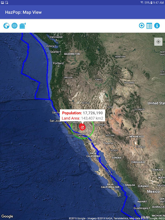
Developed by the NASA Socioeconomic Data and Applications Center (SEDAC) operated by the Center for International Earth Science Information Network (CIESIN) at Columbia University, HazPop combines data and map layers from various sources including NASA's Global Imagery Browse Services (GIBS), the U.S. Geological Survey (USGS), and others using a variety of open Web mapping services. The custom population estimates are provided by the SEDAC Population Estimation Service (PES) based on SEDAC′s Gridded Population of the World, version 4 (GPWv4) data for 2015.
HazPop is designed to be used by disaster risk managers, humanitarian response organizations, public health professionals, journalists, and others needing a quick assessment of the potential dangers posed by a major hazardous event or developing emergency. For example, a disaster response agency can obtain a rough estimate of the population and major facilities near a recent earthquake as an input into response planning. Journalists or students can explore the location of recent wildfires relative to dense populations, roads, terrain, and water bodies. Due to the coarse resolution and varying quality of some of the data, HazPop is not intended to support in-depth risk assessment or location-specific response needs.
ภาพหน้าจอ


มีอะไรใหม่
- เวอร์ชัน: 1.0
- อัปเดต:
- Initial release
ราคา
- วันนี้: ฟรี
- ต่ำสุด: ฟรี
- มากที่สุด: ฟรี
ติดตามราคา
ผู้พัฒนา
แต้มแล
ไม่พบ ☹️
การจัดอันดับ
ไม่พบ ☹️
รายการ
ไม่พบ ☹️
ความเห็น
แสดงรีวิวเป็นคนแรกเลย!
ข้อมูลเพิ่มเติม
- หมวดหมู่:
Android แอป›หนังสือและข้อมูลอ้างอิง - ระบบปฏิบัติการ:
Android 5.0 และสูงกว่า - ขนาด:
4 Mb - การจัดประเภทเนื้อหา:
Everyone - Google Play คะแนนโดย: 40
- อัปเดต:
- วันที่วางจำหน่าย:
รายชื่อติดต่อ
- เว็บไซท์:
 https://sedac.uservoice.com/
คุณอาจชอบ
-
- Biblia in Tagalog
- Android แอป: หนังสือและข้อมูลอ้างอิง โดย: Study Bible
- * * ฟรี
- รายการ: 0 + 0 การจัดอันดับ: 0 ความเห็น: 0
- แต้มแล: 0 + 556 เวอร์ชัน: Ang Biblia 21.0 We are proud to release the Holy Bible in Tagalog for Android users, completely! This app is simply designed to make it available online and offline. Once downloaded, you do not need ...
-
- PCGS Cert Verification - Coin
- Android แอป: หนังสือและข้อมูลอ้างอิง โดย: PCGS
- ฟรี
- รายการ: 0 + 0 การจัดอันดับ: 0 ความเห็น: 0
- แต้มแล: 0 + 2,195 เวอร์ชัน: 2.1.15 Whether you are a coin collector or coin dealer, before you buy a coin online, it is vital to verify its authenticity. That s where the PCGS Cert Verification mobile app comes in. The ...
-
- NGC
- Android แอป: หนังสือและข้อมูลอ้างอิง โดย: Certified Collectibles Group
- ฟรี
- รายการ: 0 + 0 การจัดอันดับ: 0 ความเห็น: 0
- แต้มแล: 0 + 270 เวอร์ชัน: 1.8.0 The new NGC App gives coin collectors access to some of the most popular research tools developed by NGC, the world s largest third-party coin grading service. This free app includes ...
-
- The World Flags
- Android แอป: หนังสือและข้อมูลอ้างอิง โดย: Ratha Sou
- * * ฟรี
- รายการ: 0 + 0 การจัดอันดับ: 0 ความเห็น: 0
- แต้มแล: 1 + 138 เวอร์ชัน: 1.3.5 This app will tell you more than just the definition of the flag of your country and more information about your country. Moreover, understand about the flags of each nations in the ...
-
- Muslim Hub | Quran Streaming
- Android แอป: หนังสือและข้อมูลอ้างอิง โดย: tiutech
- * ฟรี
- รายการ: 0 + 0 การจัดอันดับ: 0 ความเห็น: 0
- แต้มแล: 0 + 172 เวอร์ชัน: 3.1.4 Muslim hub | Azkar | Muhammad PPUH daily speech words from sunnah without the Internet Every question like is Islam and Muslim the same? you will find there and also Duas for healing -
-
- BIG Kaleidos
- Android แอป: หนังสือและข้อมูลอ้างอิง โดย: BIG vzw
- ฟรี
- รายการ: 0 + 0 การจัดอันดับ: 0 ความเห็น: 0
- แต้มแล: 0 + 7 เวอร์ชัน: 4.3.11.0 BIG Kaleidos: app to easily find data on > 5000 dangerous substances in English, Dutch, French and German. Includes data on hazards in CLP, ADR and Emergency Response. Demo mode only ...
-
- Ready South Texas
- Android แอป: หนังสือและข้อมูลอ้างอิง โดย: City of San Antonio
- ฟรี
- รายการ: 0 + 0 การจัดอันดับ: 0 ความเห็น: 0
- แต้มแล: 0 + 102 เวอร์ชัน: 3.14.3 Be prepared for disaster. The Ready South Texas app is an all-hazards overview of disaster information to help you prepare, plan and respond to disaster in your area. Using the Ready ...
-
- IATSE Safety Info
- Android แอป: หนังสือและข้อมูลอ้างอิง โดย: Winmill Software
- ฟรี
- รายการ: 0 + 0 การจัดอันดับ: 0 ความเห็น: 0
- แต้มแล: 0 + 14 เวอร์ชัน: 1.5.1 The IATSE Safety App is an information reference and hazard reporting tool for IATSE members. The application provides important safety information, such as safety hotline telephone ...
-
- Buxus
- Android แอป: หนังสือและข้อมูลอ้างอิง โดย: Sander Resources, L.L.C.
- ฟรี
- รายการ: 0 + 0 การจัดอันดับ: 0 ความเห็น: 0
- แต้มแล: 0 + 9 เวอร์ชัน: 2.13.2 Buxus provides critical information from pipeline operators to stakeholders, including emergency responders and the public. Information is specific to each operator and includes ...
-
- Michif To Go
- Android แอป: หนังสือและข้อมูลอ้างอิง โดย: Gabriel Dumont Institute
- ฟรี
- รายการ: 0 + 0 การจัดอันดับ: 0 ความเห็น: 0
- แต้มแล: 0 + 48 เวอร์ชัน: 3.33.01 The first English-to-Michif Dictionary available for Android. Features over 11,500 translations and audio pronunciations by Michif-language expert Norman Fleury. A search tool allows ...
-
- Shaban Ke Fazail
- Android แอป: หนังสือและข้อมูลอ้างอิง โดย: Khawaja Qasim
- * ฟรี
- รายการ: 0 + 0 การจัดอันดับ: 0 ความเห็น: 0
- แต้มแล: 0 + 120 เวอร์ชัน: 1.5.2 Shaban is the eighth month of the Islamic Calendar. This is the month of "separation", so called because the pagan Arabs used to scatter in search of water.The fifteenth night of this ...
-
- Read for the Blind
- Android แอป: หนังสือและข้อมูลอ้างอิง โดย: TAB Foundation
- ฟรี
- รายการ: 0 + 0 การจัดอันดับ: 0 ความเห็น: 0
- แต้มแล: 0 + 2,767 เวอร์ชัน: 3.0.37 Read for the Blind application is the world first innovation for everyone to create audio books for the blind, by reading books or short articles from magazines, newspapers or any ...
-
- Holy Bible RSV Offline
- Android แอป: หนังสือและข้อมูลอ้างอิง โดย: SOFTCRAFT
- * * ฟรี
- รายการ: 0 + 0 การจัดอันดับ: 0 ความเห็น: 0
- แต้มแล: 0 + 536 เวอร์ชัน: 3.6 We are proud and happy to release the Revised Standard Version of Holy Bible in Offline in android for free. Holy Bible Application RSV is simply designed to make it available OFFLINE ...
-
- SingStat
- Android แอป: หนังสือและข้อมูลอ้างอิง โดย: Singapore Department of Statistics
- ฟรี
- รายการ: 0 + 0 การจัดอันดับ: 0 ความเห็น: 0
- แต้มแล: 0 + 108 เวอร์ชัน: 1.8.1 Get access to commonly referenced statistics from the enhanced SingStat Mobile App. The app brings you new and improved features to enhance your data exploration experience with over ...
คุณอาจชอบ
- Android แอป
- ใหม่ Android แอป
- หนังสือและข้อมูลอ้างอิง Android แอป : ใหม่
- วิดีโอ Android แอป
- ยอดนิยม Android แอป
- หนังสือและข้อมูลอ้างอิง Android แอป : ยอดนิยม
- ลดราคา Android แอป
- หนังสือและข้อมูลอ้างอิง Android แอป : ลดราคา
- การจัดอันดับ Android แอป
- ความเห็น Android แอป
- รายการ Android แอป
- แต้มแล Android แอป